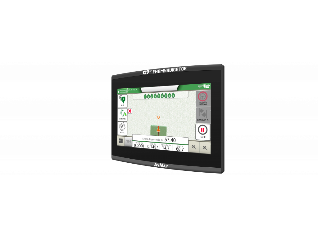
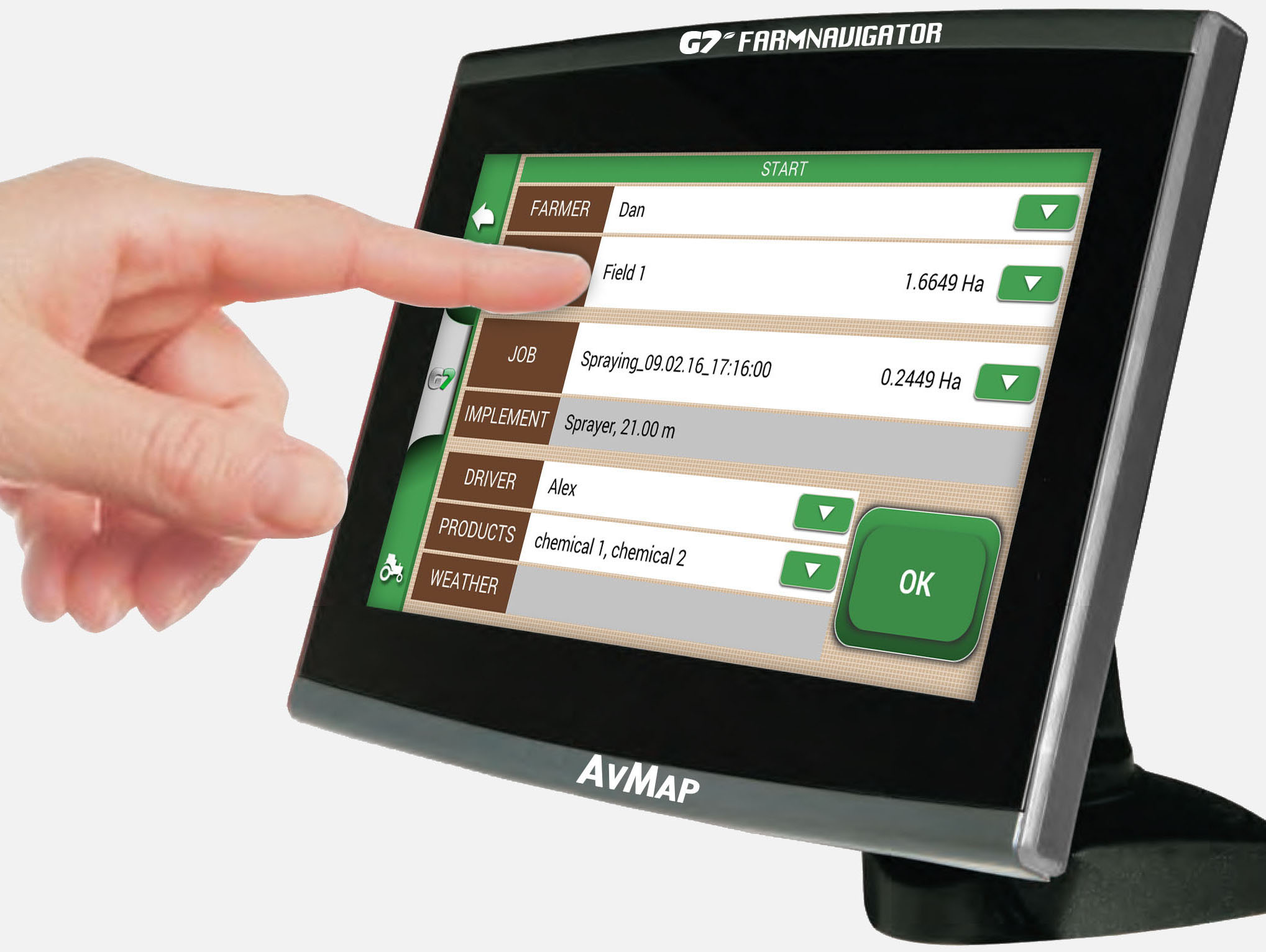
The GPS navigation system G7 Farmnavigator is an innovative field navigator designed for accurate treatment of agricultural land. It enables satellite guidance in the field and a more accurate treatment of crops. The system can be used for planting, spraying and fertilizing.

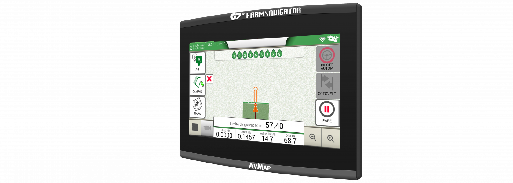
The GPS G7 Farmnavigator navigation system is an innovative field navigator designed for accurate treatment of agricultural land. It enables satellite guidance in the field and a more accurate treatment of crops. The system can be used for planting, spraying and fertilizing.
By using G7 Farmnavigator:
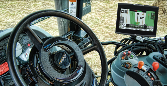
The G7 Farmnavigator features the brightest 7” sun-light readable display on the market, with incredibly high resolution and 16 million colours. The bonded LCD display features an anti-glare protection film, excellent contrast ratio, enhanced resistance to vibration and an anti-fog protection.
The entire screen is covered with an edge-to-edge tempered glass protector so it can be cleaned with a single wipe. As the display is resistant to water and dust, it can also be used in tractors without a cab.
G7 Farmnavigator is extremely resilient, light and easy to install.
The screen allows you to swipe the screen with multiple fingers for scrolling through the menu, zooming the terrain in or our and selecting the desired functions of the device.
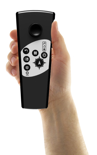
It can be connected to a remote control which can be installed anywhere in the tractor cab to provide constant control, even when driving on uneven surfaces.
It features an intuitive user interface and large buttons for user-friendly operation.
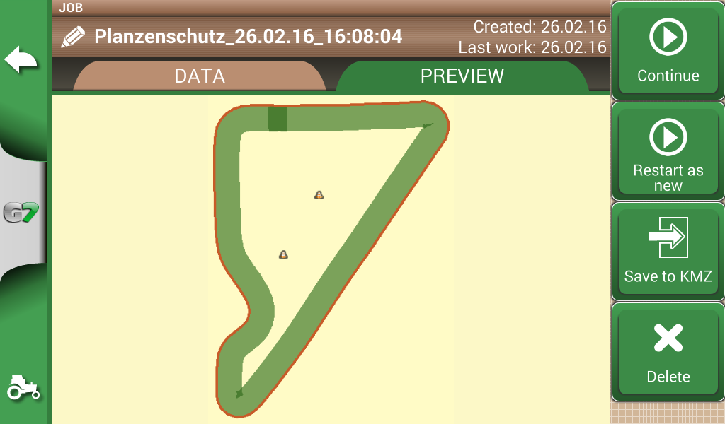
Create a database of your own fields. Measure the boundaries of your fields, calculate the surface area and save the locations of obstacles or soil samples. Any saved parcels can be retrieved easily during normal work or exported to a PC in Google Earth format.
Before starting work, you can enter the margin strip of your parcel according to the width of the tractor attachment.
The entry of margin strip data is extremely useful for parcels with irregular shapes, such as triangular fields. When activated, the automatic section control deactivates the spraying sections when the sprayer reaches the margin strip of the parcel. The latter is sprayed last to avoid any unnecessary overlapping.
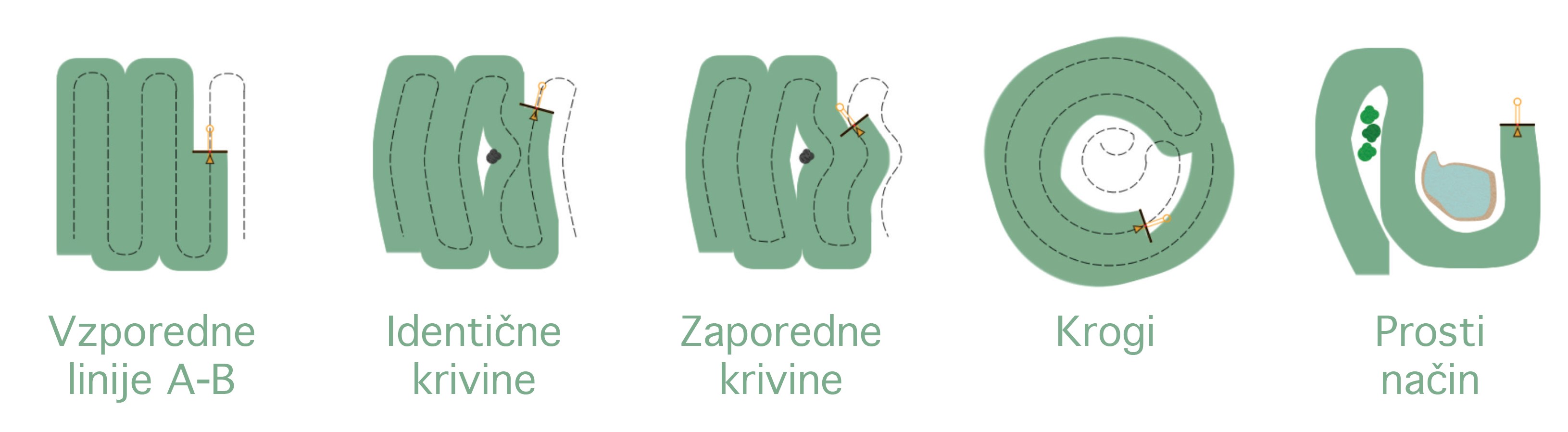
The modes of the margin strip control feature include parallel A-B lines, identical curves and consecutive curves.
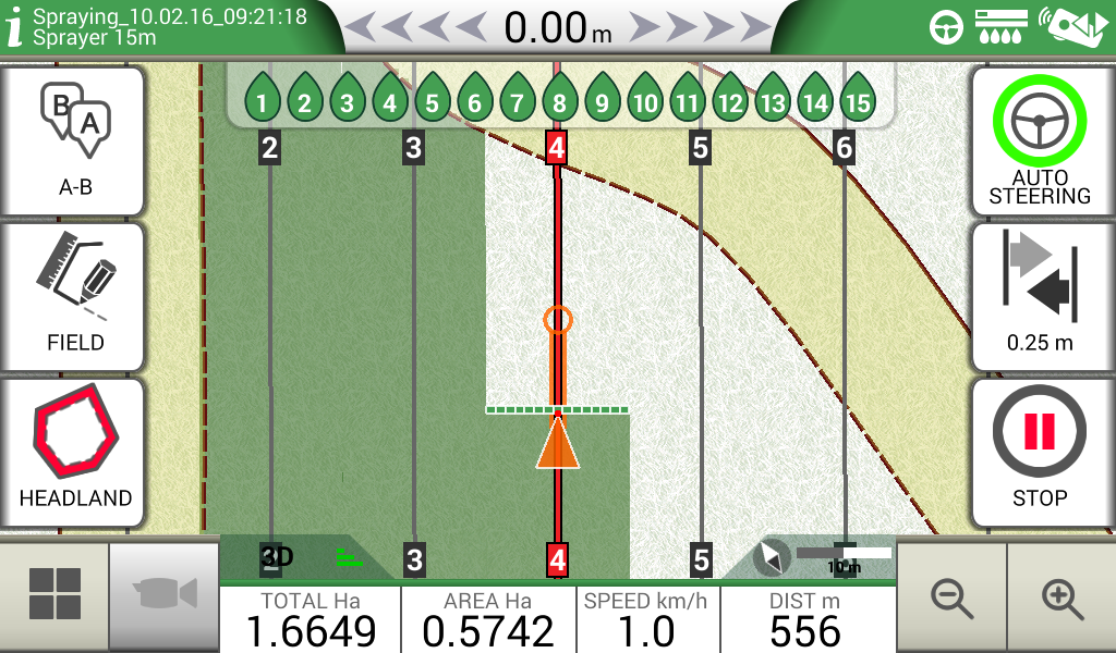
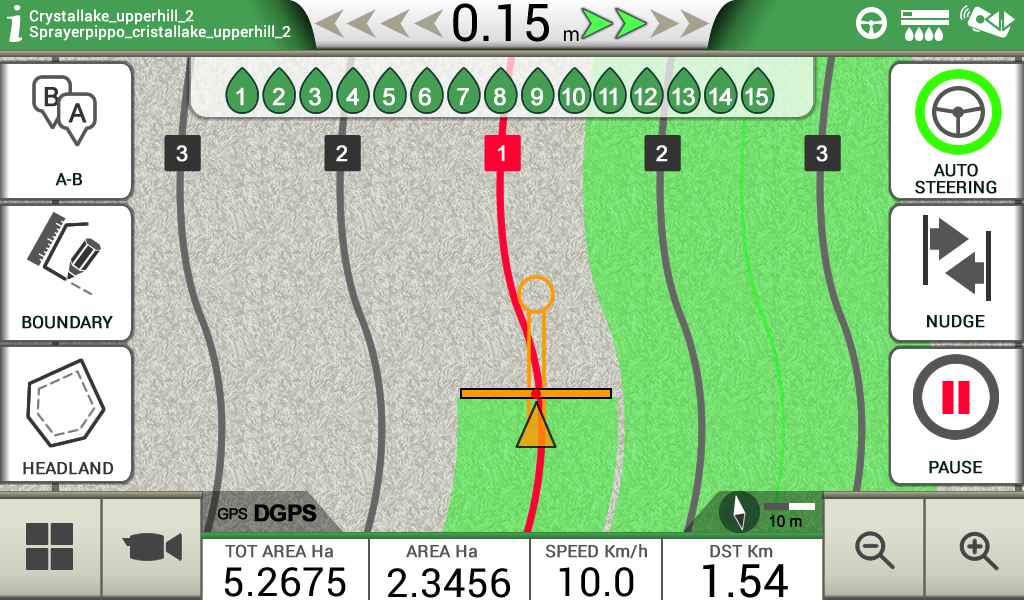
Easily determine driving guidelines and turn the steering wheel in the direction of the cursor, pointing to the course direction*. Save or remove the guidelines for future use in this particular area.
The cursor is uniquely designed to show you the exact position and direction of the route: make sure the black guideline of the current route is always within the circle at the top of the cursor. When operating wide machines (e.g. wide boom set), the cursor will help you predict the turning radius of the tractor at the end of the field. This enables you to start the necessary manoeuvre in time.
You can choose from 5 guiding modes: parallel A-B lines, identical curves, consecutive curves, circles, freestyle mode.
The selected lines can be saved for later use on the same field.
*If the system features automatic steering, this task can be performed by the computer.
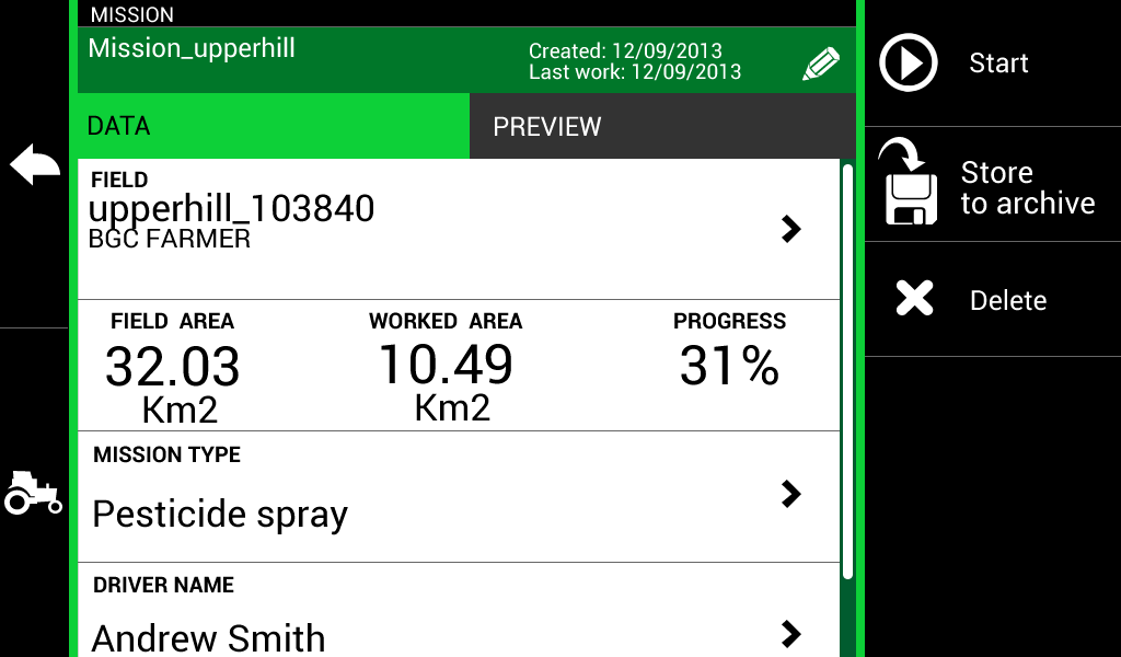
Create a specific profile for each attachment and activity, such as sowing, fertilising or spraying. Adjust the working width or the number and individual widths of sections. If a profile is selected before beginning work, you will receive instructions for precise management of sections, which leads to substantial cost savings and reduces unnecessary release of agricultural sprays in the environment.
By using the spraying computer AGtronik 14, the spraying sections can be controlled automatically. The GPS system opens and closes individual sections of the sprayer's regulator according to position, parcel boundaries and the area that was already treated.
The G7 Farmnavigator allows you to save all the data connected to individual jobs (each activity in a specific area) to facilitate subsequent checking, including the amount of sprays consumed, driver's notes, total time, treated area, implement etc.
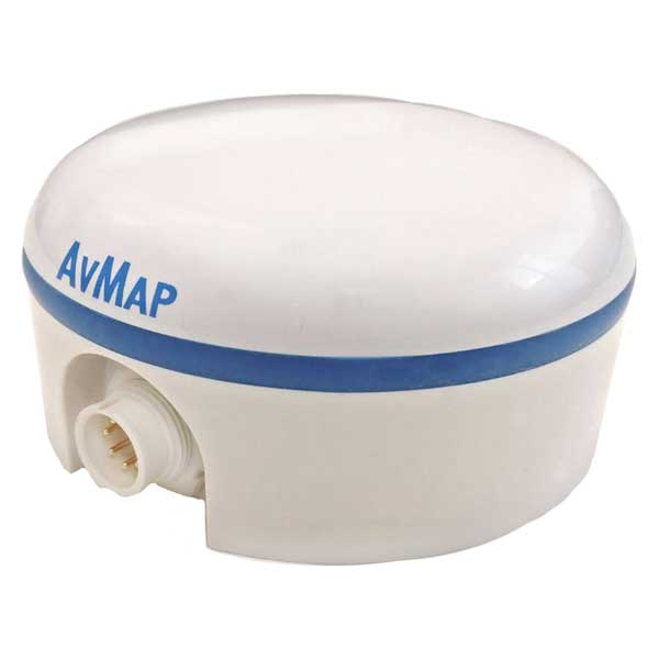
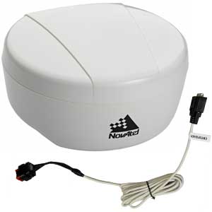
Highly efficient and compact antenna. Its robust design ensures a firm grip on the support surface and a safe passage for the vehicle. This makes the antenna ideal for high-precision operations like mapping, fertilizing and spraying.
Highly efficient and compact antenna. Its robust design ensures a firm grip on the support surface and a safe passage for the vehicle. This makes the antenna ideal for high-precision operations like mapping, fertilizing and spraying.
This antenna provides ultra-smooth positioning and exceptional pass-to-pass accuracy. It is ideal for basic high-precision operations. The antenna is compatible with automatic steering applications.
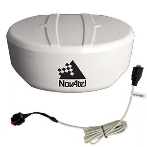
This antenna features GLIDE technology for smooth and quick transitions between applications. It is ideal for high-precision automatic steering applications.
|
COMPARISON TABLE |
|||
|
MODEL |
TURTLE SMART GPS/GNS |
NOVATEL AG STAR |
NOVATEL SMART6L |
|
L1 GPS |
yes |
yes |
yes |
|
L2 GPS |
X |
X |
optional |
|
L BAND |
X |
X |
optional |
|
GLONASS |
yes |
yes |
yes |
|
BEIDOU |
X |
X |
yes |
|
SBAS (WAAS, EGNOS, MSAS) |
yes |
yes |
X |
|
UPDATING SPEED |
10hz |
10hz |
20hz |
|
CHANNELS |
72 |
14 |
120 |
|
RTK |
X |
X |
optional |
|
SMOOTH POSITIONING |
X |
yes |
yes |
|
PASS-TO-PASS ACCURACY |
SBAS 30 cm |
SBAS + GLIDE 30 cm |
SBAS + GLIDE 30 cm L1/L2 SBAS 16 cm Terrastar 4 cm RTK 2 cm |
|
COMPATIBLE WITH G7 |
yes |
yes
|
yes |
|
CONVENIENT OPERATION |
Basic precision operations: mapping, fertilizing, spraying, harvesting |
Advanced precision operations + manual and auto-steering: seeding, spraying, planting, harvesting |
Advanced precision operations + auto-steering: seeding, spraying, planting, harvesting |
|
|
|
|
|
|
COMPARISON TABLE |
||
|
Model |
G7plus |
G7 Ezy |
|
Field perimeter and area calculation |
yes |
yes |
|
Field and jobs database |
yes |
yes |
|
Satellite assisted guidance |
yes |
yes |
|
Parallel guidelines |
yes |
yes |
|
Identical contour curves |
yes |
yes |
|
Adaptive contour |
yes |
yes |
|
Pivot guidelines |
yes |
yes |
|
Headland spraying |
yes |
yes |
|
Automatic section control |
yes |
yes |
|
Export data to Google Earth |
yes |
yes |
|
Implement configuration |
yes |
yes |
|
Auto-steering extension |
yes |
X |
|
Satellite navigation with Here Maps |
yes |
X |
|
Updates via Wi-Fi |
yes |
X |
|
HARDWARE |
||
|
DISPLAY |
7" |
7" |
|
WATERPROOF |
yes |
yes |
|
Built-in battery |
X |
X |
|
BLUETOOTH |
yes |
X |
|
Remote control |
yes |
X |
|
Serial ports |
3 |
3 |
|
OPTIONAL EQUIPMENT |
||
|
Included in the box |
Protective cover, suction holder, powered bracket, single pole plug adapter, Combo adapter, remote control, Micro SD card |
Protective cover, suction holder, powered bracket, single pole plug adapter |
|
COMPATIBLE GPS RECEIVERS |
||
|
FARMNAVIGATOR Smart GPS/GNSS |
yes |
yes |
|
Novatel AG STAR |
yes |
yes |
|
Novatel SMART6 L |
yes |
yes |
|
SUGGESTED USE |
Mapping, fertilizing, spraying + auto-steering applications |
Mapping, fertilizing, spraying |
Control the camera through the G7 screen: ideal for rear-view cameras or monitoring key components of the implement.
* A C-Box is required.
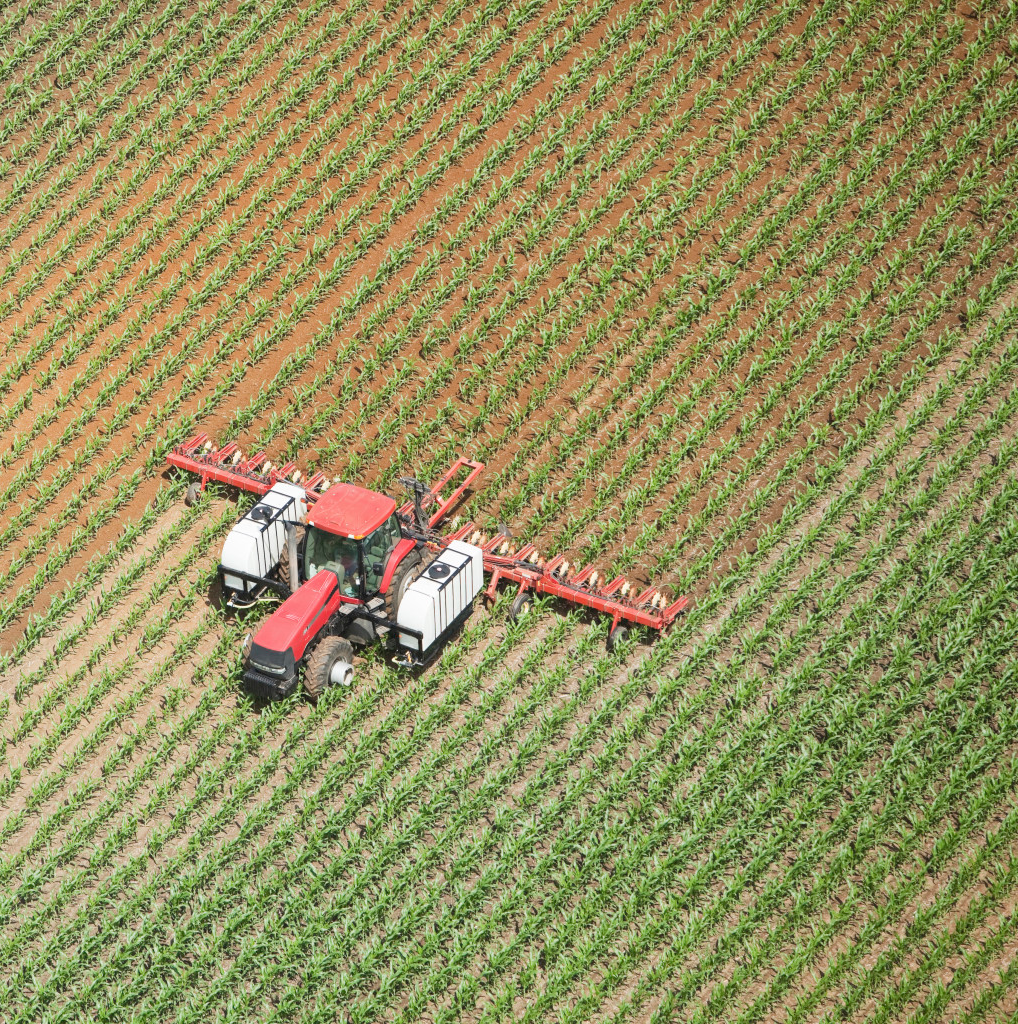
Reliable and cost-efficient tractor auto-steering system for precision farming (spraying, sowing, fertilizing etc.) that increases work accuracy, saves fuel and reduces stress and fatigue on the operator.
During surface treatment, the automatic steering system Farmnavigator controls the tractor steering wheel and maintains the selected track. It guides the machine with great precision according to the guidelines specified with G7 Plus.
This enables a changeover between manual and automatic driving mode, which means you can focus on controlling the implements instead of worrying about the steering wheel. This system will improve the treatment quality and efficiency. This type of system is very useful in poor visibility conditions: in foggy weather, dusty areas and at night.
The auto-steering system can be disengaged by firmly grasping the steering wheel; to resume the system, simply tap the corresponding icon on the G7 Plus display.
The Farmnavigator auto-steering system allows you to use the entire length of your machine, maximizing the crop treatment area and reducing overlapping. This system saves you time and money, reducing the consumption of fuel, seeds and fertilizers. As a result, it improves both the quantity and the quality of your crops, providing higher return on investment and, most importantly, it increases the performance accuracy and reduces the strain on the operator.
Farmnavigator G7 Ezy - Inštalacija in pregled
Oranje z avtopilotom